April 4th, 2024: Windy, Cold, and Light Precipitation Tomorrow
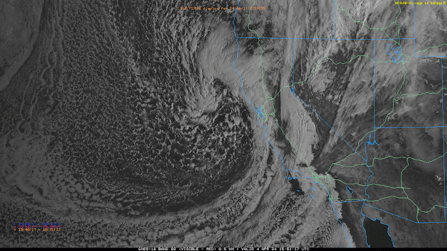
Synopsis A deep mid latitude trough will impact AZ beginning tomorrow and into early Saturday morning providing the region with gusty winds, cold temperatures, and a chance for precipitation. This system will be relatively moisture starved so mainly light precipitation is expected with the primary focus being strong winds and anomalously cold temperatures especially for this time of year. The majority of precipitation will occur over the higher terrain, but some very light rainfall accumulations are possible across the valleys. Rainfall amounts will range from a trace to 0.10 inch in the valleys and between 0.10 and 0.50 inch of SWE over the higher terrain favoring southwestern facing slopes of the mountains. Snow levels will remain above 4000 feet with between a trace to 6 inches expected and locally higher amounts possible over the highest peaks of the Mogollon Rim and White Mountains. Current Conditions At 10:54AM MST, visible satellite imagery displayed a mid latitude cycl...