Overview:
Today should be very similar to yesterday with CAPE values on the eastern half of the domain diminishing as dewpoints drop throughout the day. Moisture and instability will be more confined to the western half of Arizona and Sonora with another round of activity possible near the international border. Starting tomorrow, the pattern will begin to shift. It seems that this pattern will be characterized by more favorable positioning of the upper-level high and the attending upper-level easterly flow, but with less moisture available than this past week. The result will likely be more widespread thunderstorm activity on some days, with the threat of some pretty strong gusty winds as temperature/dewpoint spreads at the surface will be large.
Current Conditions:
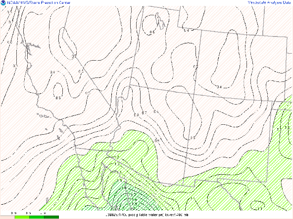
20Z Visible Sat/Precipitable Water
I have chosen a slightly wider view of the visible satellite today so that you can see the remnant clouds/vortex associated with the complex that moved through Sonora last night. In the wake of this system, convective inhibition was on the high side today, making for a later start for any activity that may develop today. Drier air is situated in the Northeast part of the state, and similar to yesterday, CAPE values are expected to diminish in eastern Arizona as the day progresses.
20Z SPC CAPE Mesoanalysis
CAPE values drop from Northeast to Southwest over the next several hours, before again recovering overnight.
00Z HRRR Dewpoint Forecast
Very quick look at the week ahead:
By tomorrow evening, the upper-level high should be situated in central Arizona, with some easterly flow in the upper levels being established by 00Z the 18th.
GFS 00Z/18th Dynamic Tropopause
Moisture availability should be near climatological values, with a distinct drop in moisture from the New Mexico border eastward.
GFS 00Z/18th PWTR Anomaly
In spite of the less than stellar conditions, most guidance suggests a more active day in the immediate Tucson vicinity. The High Res ensemble mean is showing precipitation amounts of 0.1-0.25" of precipitation with some higher elevations receiving as much as .5".
HiRes Ensemble Mean 6h QPF Tomorrow Night
This is consistent with forecasts from the UA_WRF with several initializations showing widespread coverage of precipitation in Pima County.
Forecast soundings show CAPE values of around 1000 J/kg, but with 50+ degree dewpoint depressions at the surface. Consequently, downdraft CAPES should easily exceed 1000 J/kg indicating the threat of some pretty gusty winds.
After tomorrow, some more widespread activity may return to the area later in the week as we may have some inverted troughs propagating near the international border. A full outline of the week will be posted tomorrow.
GFS 00Z/21st Dynamic Tropopause


Comments
Post a Comment