July 10 Moisture increases and convective initiation likely imminent. Weekly live discussion tomorrow at 11 AM
Overview:
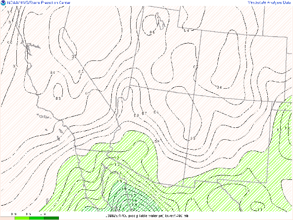
Moisture continues to increase over southern Arizona with precipitable water values exceeding 1.5 inches in the Tuscon sounding this morning and surface dewpoints exceeding 60 F. With the increasing moisture and decreasing dewpoint depressions, the hazard focus will shift slightly from gusty winds to heavier precipitation accumulations over short durations. Focus for convection for the next three days will continue to be Sierra Vista and Cochise Counties as well as parts of the Sonoran Desert in Pima County. Tucson will continue to see some chance of thunderstorm activity over the next three days with Tuesday having the greatest potential for measurable precipitation in the Tucson metro region.
There will be a more detailed look into the week ahead tomorrow at 11 AM. You can join us at https://arizona.zoom.us/j/5237305771
This Morning:
Clouds from this morning have cleared out from SE to NW across the region, clearing the way for increasing instability. Towering Cumulus Clouds are currently starting to bubble up over the higher terrain in Sierra Vista in particular.
The moisture and higher dewpoints have done a good job of sticking around so far today with dewpoints still near 60F at 1 pm
These differences may seem small, but they can have a significant impact on destabilization. The mesoanalysis indicates about 500 J/kg of CAPE over the Tucson metro, with a 1000 J/kg near the Sierra Vista/Pima County border.
The GFS initialization, which has the best current thermodynamics relative to observations is a bit more aggressive, showing more convection moving into Pima county between 6 and 8 PM.
The small difference in Dewpoint of say 51 to 54F between the models is sufficient to produce a 300 J/kg in CAPE.


Thanks for these. Keep 'em coming.
ReplyDelete