July_07_2023 Monsoon Kickoff this Weekend?
Overview:
Moisture looks to become more established in southern Arizona this weekend into at least the middle of next week. Chances of convection should increase from south to north this weekend starting with Sierra Vista and Cochise counties on Saturday and moving into Pima county on Sunday. Some convection is possible in Pima county on Saturday although any convection that does develop is likely to be more conducive to lightning strikes and some outflow breezes rather than any wetting rains.
What are the foreasts of the different models:
Let's take a look at the different model forecasts for the weekend working from the large scale down to the mesoscale.
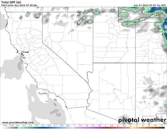
GFS Total QPF-Saturday
GFS-Sunday
ECMWF-Saturday
ECMWF-Sunday
SREF-Saturday (probability of QPF>.01)
SREF-Sunday
HRRR-QPF Saturday (Sunday unavailable)
UA-WRF_HRRR QPF Saturday
UA-WRF_HRRR QPF Sunday
Take Home Point: Most available guidance is favoring Sunday relative to Saturday, particularly for any measurable precipitation into the Tucson area. The reasons for this appear to be related to 1) better moisture availability and 2) a displaced upper-level high and slightly cooler 500 hPa temperatures. The UA WRF is an outlier with greater emphasis on Saturday relative to Sunday. The diminished activity on Sunday in the UA WRF may simply be a result of the forecast convection on Saturday reducing instability on Sunday.
How do the different UA-WRF runs compare?
UA-WRF_GFS Reflectivity
UA-WRF_RR Reflectivity
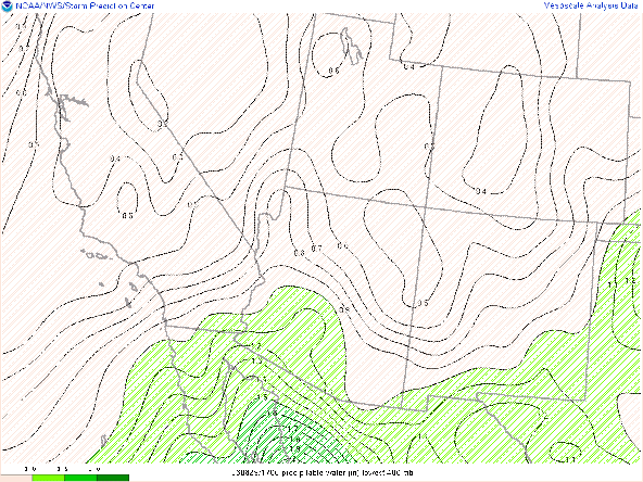
Take Home Point: All of the UA WRF runs show significant activity on Saturday although the UA WRF HRRR initialization is most aggressive in pushing activity into Pima County. Looking for differences in the initializations, the HRRR run appears to be the most aggressive with PWTR.
My Observation: All things being equal, Sunday appears to be the more favorable day from a large scale viewpoint, with slightly cooler 500 hPa temps, more established and deeper moisture, and flow from the from the Southeast.
500 hPa UA_WRF HRRR Saturday
500 hPa UA_WRF HRRR Sunday
However, which day is more conducive to rain is not as important as the fact than we may seem some rain over the next 2-5 days.
Here is a sounding from the Saturday evening in the aggressive UA_WRF HRRR run
Severe Threat: Unlikely
Hazards: Blowing Dust and Dry Lightning
Timing: Convection should initiate in the 1-3 timeframe on the higher terrain in Sierra Vista/Cochise counties. Initiation in Pima county will likely depend on outflow boundaries. Lifting condensation levels remain high, so outflow may be more effective in initiating updrafts in the valleys a little later in evening as temperatures cool slightly and cloud bases descend.
Favored Locations: South or Southwestward facing slopes Saturday, Southeastward facing slopes Sunday.


Comments
Post a Comment