July_09_Prospects for convection in Pima County today.
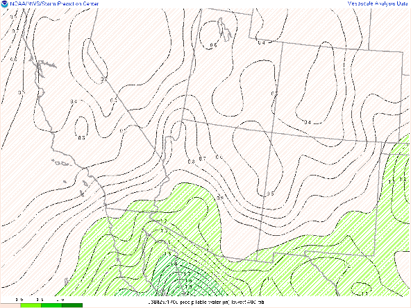
Overview: The proximity of the upper-level high pressure system will continue to limit convection even though moisture is finally in place up through the Pima/Pinal county border. Clouds rolling through eastern Pima County this afternoon will act to delay/limit destabilization into the greater Tucson. The cloud cover should have the impact of 1) delaying convection initiation today and 2) perhaps shifting the focus of convection a little further west of the Tucson area.
General Setup:
The 500 hPa flow shows the upper-level high situated near the AZ/NM border with flow from the south in our area.
While the satellite derived product below shows a similar story moisture wise, the proverbial fly in the ointment is the region of cloudiness working its way northward as of 12 MST into the greater Tucson area.
This area of cloudiness is somewhat limiting CAPE and increasing convective inhibition.
As of 12 MST, CAPE values into Pima county are less than 500 J/kg with remaining convective inhibition that was not well forecast by 12Z mesoscale models. This should delay the onset of convection until after 3 PM MST.
Comparison of initiation in the different UA_WRF models:
UA WRF_HRRR_12Z
UA_WRF_HRRR_15Z
UA_WRF_GFS_12Z
Each of the above images represents the start of significant reflectivities in each of the UA WRF initializations. The 12Z GFS initialization is the most optimistic of the 3 model runs with convection triggering by 3 PM MST relatively close to Tucson. The 15Z HRRR initialization is the most pessimistic with convection delayed to 5:30 MST and more importantly, confined to the international border.
We can compare the cloud cover in the models to see which is best depicting the current cloud cover conditions in the area.
UA_WRF_HRRR_12Z
UA_WRF_GFS_12Z
It's appears that both the 12 Z runs somewhat underdone on the extent of cloud cover. The 15Z run has a better representation of cloud cover over the Tucson area but might be a little overdone, particularly in Cochise County.
My impression is that the truth lies somehwere in between the 12 and 15Z runs of the HRRR initializations. Convection is likely to be delayed to 4 or 5 PM MST but I expect coverage that is more consistent with the 12Z HRRR run with still a possibility of convection into the Tucson region.
Inverted "V" soundings and extremely light winds through the column suggest that gusty winds associated with evaporative cooling is likely to be the most prevalent hazard, although some localized flooding with relatively slow movement is also possible.


Comments
Post a Comment