Quick Update _ July 15th
Overview:
Somewhat moist conditions persist into this morning with dewpoint temperatures still in the 60s from Tucson south and east. Precipitable water values in this morning's sounding remain on the high side of climo with a value of 1.57". Convective Available Potential Energy was already present in the 12Z Sounding and current mesoanalyses show values of over 500 J/kg as of 10 AM. The presence of significant convective inhibition exists is keeping things from firing this morning and early afternoon, and there will be a race between the large scale drying which should set in from the north, vs surface heating. Most guidance continues to show any significant activity remaining near and or south of the border, where moisture is expected to persist throughout the day and CAPE values are large. Otherwise the main story will be the continued heat, which research has shown to have cumulative effects, particularly considering how warm our overnight temperatures have been.
Conditions this Morning:
12Z Sounding
The 12 Z sounding from this morning shows about 500 J/kg of mixed layer CAPE and about half that much Convective Inhibition.The sounding is fairly moist throughout as a function of the widespread cloudiness overnight. Winds throughout the column remain essentially non-existent, again meaning that organization/propagation would not be a factor should any storms actually fire.
17Z Surface Obs
Temperatures where already around 100 F as of 17Z this morning. PHX looks to be well on its way to another 110+ F day. While the dewpoint at TUS was still at 62 F, most of the area has seen dewpoints drop back a bit into the 50's, with significantly drier air evident further north.
17Z Vis Sat and Precipitable water
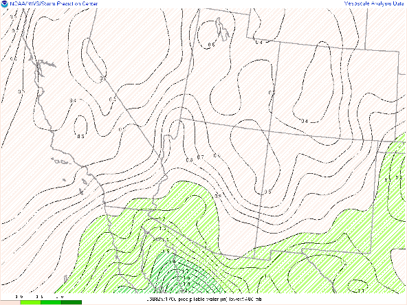
The satellite picture shows that most of the cloudiness has cleared out from this morning, but along with that, precipitable water values have dropped, with values of over 1.5" now being confined to the Sonoran Desert and the Gulf of California.
17Z CAPE/CINH
Most of southern Arizona remains capped, which is consistent with the lack of cumulus development in the satellite picture in spite of CAPE values near 1000 J/kg. Extreme values of CAPE are located south of the border where the CINH has largely eroded.
Forecast for Today:
Interestingly, CAPE values are expected to be peaking around now, and diminishing as the day progresses.
23Z Forecast CAPE/CINH
This is a function of the drier air moving in from the North. This can be seen in the High Res Ensemble forecast dewpoints....
23Z Forecast dewpoints
and precipitable water values which are forecast to drop back to 1.2" by this afternoon.
23Z Forecast PWTR


Comments
Post a Comment