Posts

Showing posts from August, 2023

August 31st: Better Storm Chances and Much Cooler Temps Today and Tomorrow

Image
Synopsis Better synoptics combined with sufficient moisture and instability will promote a much greater chance for showers and thunderstorms across Arizona today and tomorrow with tomorrow being the most active day. With lower mid level heights and decent low level moisture, high temperatures will be significantly cooler as well. Current Conditions  A strong thunderstorm cluster impacted the Tucson vicinity yesterday evening with strong winds, blowing dust, and even a bit of rainfall.  NWS 24-hour accumulated precipitation map. A severe storm over northeast Tucson dropped quarter sized hail via SPC storm reports too.  SPC Hail reports from yesterday. The mid level anticyclone which has been providing Arizona with extreme heat has finally weakened significantly and is now centered over central New Mexico. This puts Southern Arizona under easterly/southeasterly flow aloft. SPC 500mb analysis as of 1700z. An overnight Gulf of California moisture surg...
August 30th: Chance for Storms this Evening in Southeastern AZ

Image
  Synopsis CAMs are hinting at the possibility of a few showers and storms in the Tucson vicinity by this evening. Most activity will remain confined to the higher terrain this afternoon and evening with just enough moisture and instability to advertise a chance in Tucson. Hot temperatures will also continue this afternoon.   Current Conditions The 12z TUS sounding this morning measured a slightly better thermodynamic profile compared to yesterday with a weaker subsidence inversion near 500mb, around 300 J/kg of CAPE, and over 1500 J/kg of DCAPE.  12z TUS sounding courtesy of the SPC. Moisture is marginal with SPC mesoanalysis displaying pwats between 1 and 1.25 in across Southern Arizona with highest values near the International Border. SPC Mesoanalysis of total precipitable water as of 19:00z. Today's Forecast  Synoptics As shown on the 12z Tucson sounding, the area of subsidence above 500mb is slightly weaker today due to 500mb ...

August 29th: Hot and Mostly Dry Today

Image
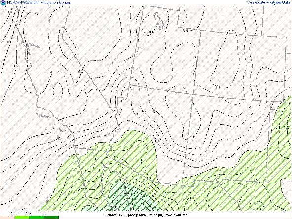
  Synopsis Significantly drier and more stable conditions today leading to minimal convection and very hot temperatures this afternoon and evening.  Current Conditions High temperatures were brutal across the lower deserts yesterday with Tucson International Airport reporting a max temp of 109 degF, Phoenix Sky Harbor reporting 117 degF, and Yuma Marine Corp Air Base reporting 118 degF. All WRF runs yesterday were forecasting temps a few degrees cooler than what was observed with the raw HRRR having the most accurate high temp forecast.  Significant drying has occurred across Arizona with pwats down to around an inch or less via SPC mesoanalysis this morning. SPC mesoanalysis of total precipitable water as of 17:00z this morning. The mid level anticyclone is currently centered over western AZ with primarily northeasterly winds aloft over much of Arizona.  SPC 500mb analysis at 17:00z this morning. The 12z TUS sounding was depressing with CAPE around 30...

August 28th: Chance for Showers and Storms in Southeastern AZ; Extreme Heat Continues Across Lower Deserts

Image
  Synopsis Rinse and repeat type pattern today with just enough low to mid level moisture and instability for a chance of afternoon and evening storms across southeastern AZ (including Tucson). Another day of extreme heat with temps around 105 degF in Tucson with temps between 110 degF and 115 degF between Phoenix and Yuma. Current Conditions  Visible imagery already showing a few weak cells developing over the sky islands and White Mountains. Visible Imagery as of 19:00z courtesy of the College of Dupage. SPC 500mb analysis displays the mid level anticyclone centered over Southern CA and weak northerly/northeasterly mid level flow across Arizona.  SPC 500mb analysis as of 19:00z. The 12z TUS sounding still measuring marginal thermodynamics and moisture below 500mb with some subsidence in the upper levels above 500mb.  12z TUS sounding courtesy of the SPC. Today's Forecast Synoptics The only real synoptic change is the more northeasterly mid level flow...