August 28th: Chance for Showers and Storms in Southeastern AZ; Extreme Heat Continues Across Lower Deserts
Synopsis
Rinse and repeat type pattern today with just enough low to mid level moisture and instability for a chance of afternoon and evening storms across southeastern AZ (including Tucson). Another day of extreme heat with temps around 105 degF in Tucson with temps between 110 degF and 115 degF between Phoenix and Yuma.
Current Conditions
Visible imagery already showing a few weak cells developing over the sky islands and White Mountains.
 |
| Visible Imagery as of 19:00z courtesy of the College of Dupage. |
SPC 500mb analysis displays the mid level anticyclone centered over Southern CA and weak northerly/northeasterly mid level flow across Arizona.
 |
| SPC 500mb analysis as of 19:00z. |
The 12z TUS sounding still measuring marginal thermodynamics and moisture below 500mb with some subsidence in the upper levels above 500mb.
 |
| 12z TUS sounding courtesy of the SPC. |
Synoptics
The only real synoptic change is the more northeasterly mid level flow across southeastern AZ due to the center of the high now over SoCal. Conditions above 500mb will remain hostile to ascent today due to synoptic scale subsidence induced by the mid level high. Northeasterly steering flow, albeit weak, is actually working in favor of storms making it into Tucson by this evening.
Thermodynamics
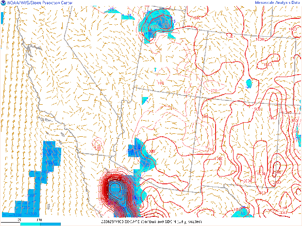
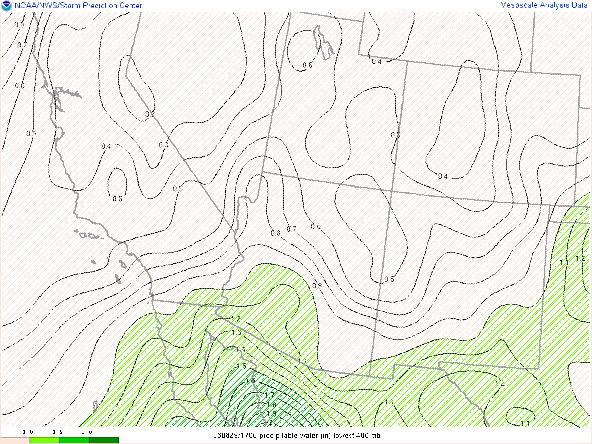
WRF forecasts pwats to remain around 1.25 in across southeastern Arizona into this afternoon and evening. The 12z WRF-HRRR forecasts CAPE in Tucson to max out at just over 300 J/kg, but once again this is likely a slight underestimation. The issue, as been the case the past few days, is the hostile thermodynamic environment in the upper levels due to synoptic scale subsidence induced by the close proximity of the mid level anticyclone.

12z KTUS WRF-HRRR sounding for today at 4:00 PM MST.
 |
| SPC mesoanalysis of SBCAPE as of 19:00z. |
Am thinking CAPE will likely reach around 500 J/kg in the Tucson vicinity by late this afternoon and evening. One component which is better today is the DCAPE due to hotter surface temperatures. WRF forecasting DCAPE to reach around 1500 J/kg in Tucson by late this afternoon which is plenty sufficient enough for strong outflow boundaries.
What to Expect
As has been the case the past few days, storms will likely remain low-topped due to the subsidence in the upper levels. However, enough low and mid level moisture and instability will be in place today for scattered showers and storms across southeastern Arizona (including Tucson) with the best chances remaining confined to the higher terrain. Am thinking this afternoon and evening will be marginally more active compared to the past few days due to the high levels of DCAPE to produce strong outflow boundaries. Both the 12z and 15z WRF-HRRR are advertising outflow to propagate off the White Mountains by this afternoon and move southwestward toward the Tucson region by this evening.
12z WRF-HRRR simulated maximum reflectivity for today at 4:00 PM MST. 12z WRF-HRRR simulated maximum reflectivity for today at 6:00 PM MST.
12z WRF-HRRR simulated maximum reflectivity for today at 8:00 PM MST.
12z WRF-HRRR simulated maximum reflectivity for today at 9:00 PM MST.
The main threat from any storm will be locally gusty outflow winds and blowing dust due to the dry sub cloud layer. In general, slightly better chance this afternoon and evening for showers and storms in the Tucson metro with most activity still likely to remain over the higher terrain.
It will be very hot this afternoon with max temps reaching around 105 degF in Tucson with the lower deserts between Phoenix and Yuma reaching temps between 110 and 115 degF with a few isolated spots possibly reaching slightly greater than 115 degF.
 |
| 12z WRF-HRRR 2-meter temps for today at 3:30 PM MST. |


Comments
Post a Comment