Aug 10th - More widespread convection expected in Southeastern Arizona as we head into the weekend
Overview:
Today appears to be a transitional day as the flow regime evolves from southwesterly to southerly over the next 24 h. Somewhat limited moisture and a lack of favorable dynamics should keep activity on the sparse side today with most activity being confined to the south and east of Tucson. By tomorrow, southerly flow will intensify over the region between an upper-level low situated near Monterey, CA and the persistent subtropical high over Texas. An upper-level jet streak may develop into central Arizona which would create favorable upper-level divergence while the southerly flow advects better moisture northward from Sonora, Mexico. This should set the stage for more widespread activity even though instability may be somewhat limited by less-than-ideal lapse rates. Activity in Sonora should help with moisture, although forecasts may be complicated by cloud cover left over from overnight activity. This general setup should persist into at least Saturday.
Today:
The general setup for taday is illustrated in the water vapor imagery below:
Water Vapor Imagery from 8 AM MST Thursday
The trough axis that impacted our weather on Tuesday has shifted into the Midwest setting the stage for a potentially active day in parts of the Middle Atlantic and Southeastern United States. An upper-level low is situated along the central California coast, while the high-pressure system that has plagued Texas and Louisiana this summer remains situated near the Texas Gulf Coast. Upper-level water vapor is being funneled northward between the these features as highlighted in the image above.
The visible satellite image overlayed with the GOES derived precipitable water shows generally clear skies over the region, with PW values of greater than 1.5" confined to areas near the Gulf of California as well as parts of Sonora Mexico.
Vis Sat with GOES PWTR from 8 AM MST Thursday
This morning's sounding from Tucson shows a rather unremarkable setup for today.
Tucson Sounding from 5 AM MST Thursday
Lapse rates ranging between 6 and 6.5 C/km above the boundary layer suggest rather limited instability for today as evidenced by the forecast CAPE value of 457 J/kg for this afternoon. Relatively moist mid and upper levels also limits the potential downdraft CAPE with values of 779 J/kg suggesting that outflows today likely stay below severe limits in terms of wind speeds. The shift to a southerly flow regime is already evident above 500 hPa, and this should continue to work down to the 700 hPa layer as the day progresses. Precipitable water values of 1.32" are close to climatological norms with values expected to decrease slightly over the course of the day ahead of the moisture surge expected overnight.
The exact timing of this moisture surge is somewhat of an issue, as this morning's run of the UA_WRF shows an increase in PW heading into the evening hours tonight.
12Z UA_WRF HRRR PWTR valid at 6 PM MST Thursday
You can see a narrow corridor of PW values approaching 36 mm or 1.4" in the UA_WRF forecast as early as 5-6 PM this evening. This increase in moisture in the model is accompanied by the development of limited convection that propagates from Santa Cruz County into South Tucson.
12Z UA_WRF HRRR reflectivity valid at 6:30 PM MST Thu
While this solution is plausible, it is not supported by an ensemble of the available guidance, either from runs of the UA_WRF or the HREF ensemble suite from the Storms Prediction Center which shows precipitation being confined to the higher terrain south of Tucson
12Z HREF 3hr Max Precip valid at 8 PM MST Thursday
However, as the moisture surge is expected overnight, a continuation of at least some rain showers into Friday morning cannot be ruled out.
12Z HREF 3hr Max Precip valid at 5 AM MST Friday
Friday:
The figure above shows the proverbial "fly in the ointment" for Friday which is the extent of cloud cover. Otherwise, Friday should present increasing favorable dynamic and thermodynamic characteristics for widespread convection.
The HREF shows significant mid and high-level clouds persisting throughout southcentral Arizona into the mid-morning hours on Friday.
12Z HREF Mean Cloud Cover valid at 8 AM MST Friday
This cloud cover may limit or delay instability, even as we see increasingly favorable jet dynamics.
12Z GFS 250 hPa wind valid at 11 AM MST Friday
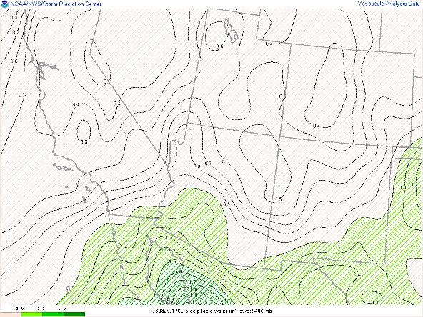
The figure above shows the development of a southerly jet streak at 250 hPa with the favorable right entrance region situated over southeastern Arizona.This jet entrance region should encounter favorable moisture with preciptable water values in the HREF exceeding 1.4" by afternoon.
12Z HREF Mean PWTR valid at 8 5 PM MST Friday
And a decent thermodynamic profile with forecast CAPES of 1000 J/kg.
12Z UA_WRF HRRR sounding valid at 1:30 PM MST Friday
Note that my personal expectation is that the surface dewpoint in the above figure is underdone, but this may be offset by diminished surface heating from morning clouds.
Given the boost from upper-level dynamics, any clearing in the morning should result in relatively early initiation of convection.
12Z UA_WRF HRRR reflectivity valid at 3:00 PM MST Friday
Given the coverage, early onset, and favorable dynamics, some heavy rainfall amounts are possible with the HREF showing a greater than 30% probability of rainfall amounts exceeding 1".
12Z HREF 3hr Max Precip valid at 5 PM MST Friday
Given the relatively moist profiles combined with smaller than usual (for this summer anyway) dewpoint depressions, severe winds are less of a threat that with many of the events that we have had so far this summer. While wind speeds of greater than 30 knots are likely to occur, wind speeds approaching severe limits should be relatively isolated.12Z HREF 4hr Max Wind valid at 4 PM MST Friday


Comments
Post a Comment