Aug 12th - Sufficient moisture remains in place for scattered thunderstorms over higher terrain today while drying expected for Sunday
Overview:
Precipitable water values today are sufficient for scattered convection across the area. A lack of early morning cloud cover should also lead to better destabilization across the eastern portion of the region as compared to yesterday. However, some of the issues from yesterday remain in place today. Lapse rates remain marginal for the development of significant CAPE, although some drying of the column should result in larger DCAPE values than yesterday, and more significant outflows. Mid-level flow remains weak, especially relative to the strength of the upper-level flow. This will mean slow updraft propagation in the presence of significant shading from downstream anvils. The combination of factors will make it difficult for storms to propagate off of the higher terrain and into the valleys. By tomorrow, significant drying of the column should lead to a general shutdown of convective activity for tomorrow. For the long range, keeping an eye on tropical activity in the eastern Pacific... stay tuned.
Today:
15:50Z Water Vapor Image (weather.cod.edu)
The water vapor image from this morning highlights the features of interest for our weather today including the upper-level low pressure system just off the coast of California and the upper-level high pressure system situated over Louisiana. The yellow highlights a dry-slot circulating around the upper-level low, while the orange area highlights a region of positive potential vorticity advection for today and with it a threat for more widespread convection in the northwestern part of the state. Eastern Arizona is in a bit of a dead spot in the flow to the east of the south-southwesterlies associated with the trough and to the west of the south-southeasterlies associated with the ridge.
You can readily see this lack of mid-level flow in this morning's sounding.
12Z TUS Sounding (spc.noaa.gov)
While southerly flow of 30+ knots is evident at 300 hPa the flow in the 700-500 hPa layer is essentially light and variable. Consequently, we can expect any convection that does develop to move quite slowly while the anvils expand to the north-northeast. The shading from these anvils may limit destabilization in the valley and the lack of steering flow suggests difficulty in propagating storms into the valley. Otherwise, lapse rates near 7 C/km are marginally conducive for the development of significant CAPE, although with clear skies this morning and slightly steeper lapse rates than yesterday, we may see marginally higher values of CAPE this afternoon with forecast surface-based CAPE near 750 J/kg. Also, drying in the mid and upper levels of the atmosphere as compared to yesterday should lead to slightly higher DCAPE values and the chance of gustier outflows in convection that does develop. Precipitable water values are still on the plus side of climatology (1.41" in the sounding) and relatively widepread as can be seen in the GOES derived image below:
16:30Z Vis Sat and PWTR (weather.cod.edu)
Values of precipitable water of greater than 1.25" are fairly widespread in southern Arizona and likely won't be the limiting factor today.
Significant synoptic-scale help in the development of convection will be confined to west and north of Tucson as the upper-level low pushes east through California. This is best illustrated by the pressure on the dynamic tropopause as shown below:
12Z GFS Initial Analysis Pressure on the DT (topicaltidbits.com)
This morning the center of the upper-level circulation is situated near Los Angeles and by 06Z Sunday (11 PM MST Saturday), the center of this feature should be approaching Las Vegas.
12Z GFS Pres on the DT Valid 11PM MST (topicaltidbits.com)
The positive potential vorticity advection incurred by the eastward progression of the upper-level trough should induce synoptic scale ascent in western and in particular northwestern Arizona. This is supported by the convergence of Q-Vector map seen below:
12Z GFS Q-vector div valid at 5 PM MST (topicaltidbits.com)I circled the area of Q vector convergence which is the same as the region of implied synoptic-scale ascent. Because of this, the threat of rainfall will shift to the northcentral and northwest part of the state, as can be seen in the HREF precipitation map below:
12Z HREF 3 hr max precip valid at 5 PM MST (spc.noaa.gov)
Closer to home, the HREF precipitation map highlights the convective potential to the southwest and northeast of the greater Tucson metro area. Looking at the UA_WRFHRRR, you can see the northward anvil progression away from the updraft cores by 3 PM.
Eventually, we are left with weak reflectivities overspreading the valley associated with dying convection and anvil precipitation.
Sunday:
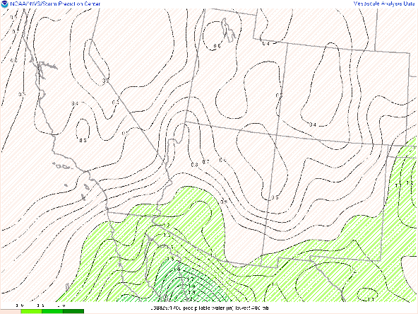
The dry slot will usher in lower values of precipitable water, with values of an 1" or less becoming established over Tucson.


Comments
Post a Comment