August 15th: Scattered Showers and Thunderstorms Today
Synopsis
Southeasterly flow aloft and sufficient moisture will continue to provide chances for scattered showers and thunderstorms across southern Arizona this afternoon and evening. The primary inhibiting factor will be instability with only a few hundred J/kg of CAPE expected across the region. Today will be fairly similar to yesterday with scattered showers and a few low-topped thunderstorms expected across southern Arizona with the most widespread, intense activity remaining over the higher terrain. Temperatures will remain at or below 110 degF across the lower deserts today as well.
Current Conditions
SPC 500mb analysis this morning displayed a near identical pattern compared to yesterday with southeasterly flow aloft over Arizona, a cutoff low off the coast of California, and a weak disturbance (associated with overnight convection in Sonora) moving northward into far southeastern Arizona. The only difference is the mid level anticyclone has built northwestward, centered over Eastern New Mexico, which has caused 500mb heights to rise to between 592 and 594 dm across the state.

SPC 500mb analysis as of 17:00Z this morning.
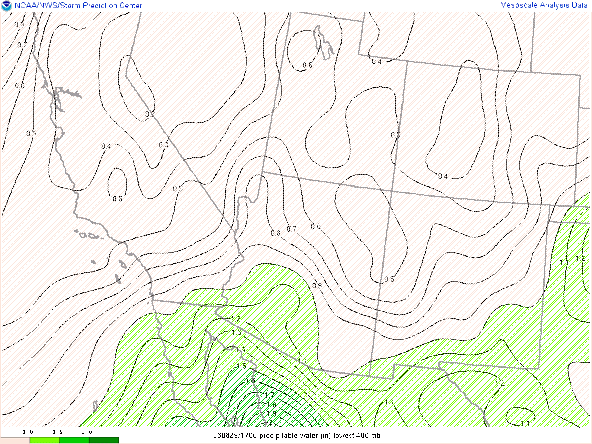
Visible Imagery overlaid with GOES derived total precipitable water at 17:00z this morning courtesy of College of Dupage.
 |
| Surface Observations as of 17:00Z this morning courtesy of the NWS. |
 |
| 12z PHX sounding courtesy of the SPC. |
Today's Forecast
Synoptics
The synoptics are quite similar to yesterday with southeasterly 500mb flow and a weak cyclonic disturbance lifting slowly northward into southeastern Arizona. This weak disturbance will provide some synoptic scale ascent due to very marginal positive vorticity advection across southeastern and south-central Arizona this afternoon and evening.
 |
| 12z GFS 500mb absolute vorticity at 12z this morning. (X indicates vort max) |
 |
| 12z GFS 500mb absolute vorticity at 18z this morning. (X indicates vort max) |
Thermodynamics
Again, similar to yesterday, poor buoyancy will likely prevent any strong thunderstorms from developing. The 12z KTUS WRF-HRRR model sounding has CAPE maxing out early this afternoon at just over 100 J/kg which is far from sufficient. Models are forecasting a somewhat dry sub cloud layer below 700mb so DCAPE is expected to reach over 1000 J/kg by early this afternoon. This will promote the development of outflow boundaries which would help generate some additional lift. Moisture is also a favorable factor today with precipitable water remaining near 1.25 and 1.50 in across the region into this afternoon and evening.
| 12z KTUS WRF-HRRR sounding for 1:00 PM MST this afternoon. |
What to Expect
With some weak synoptic scale lift, sufficient DCAPE for outflow boundaries, and plenty of moisture, scattered showers and isolated thunderstorms will be possible across southern Arizona today as well as over the White Mountains and Mogollon Rim. However, very poor instability will most likely promote low-topped cells with the best chances for stronger storms mainly over the higher terrain. Similar to yesterday, today's setup promotes more of a "showery" type day. A few thunderstorms will be possible though but mainly remaining confined to the higher terrain and west of Tucson where slightly better instability is expected.
Below is the evolution of convection today according to the 12z WRF-HRRR.
12z WRF-HRRR simulated maximum reflectivity at 2:00 PM MST.
 |
| 12z WRF-HRRR simulated maximum reflectivity at 3:00 PM MST. |
 |
| 12z WRF-HRRR simulated maximum reflectivity at 4:00 PM MST. |
12z WRF-HRRR simulated maximum reflectivity at 6:00 PM MST.
12z WRF-HRRR simulated maximum reflectivity at 8:00 PM MST.
One thing to keep in mind though today is that models had forecast convective initiation a couple hours too early yesterday. This could possibly be the case today especially with poor instability. Either way scattered showers and isolated thunderstorms can be expected across the state today with the best coverage over the higher terrain.
Temperatures will be on the cooler side in southeast Arizona with Tucson most likely remaining under 100 degF. Areas between Phoenix and Yuma will range between 105 and 110 degF by this afternoon.
12z WRF-HRRR 2-meter temps for this afternoon at 3:30 PM MST.


Comments
Post a Comment