August 20th: Heavy Rain, Strong Winds, and Even a tornado or two
Synopsis
Tropical Storm Hillary is currently centered a few hundred kilometers south of San Diego and is expected to move through SoCal throughout the day today into tonight. Showers and thunderstorms can be expected this afternoon and evening mainly across the higher terrain of Arizona as well as in the Colorado River Valley. Storm chances for Phoenix and Tucson increase tonight as an area of upper level difluence should aid in ascent. The SPC has most of Arizona in a marginal risk for severe storms today with far western AZ and southeastern CA in a slight risk. Impacts can include strong gusty winds, heavy rain, and even a tornado or two (mainly in far western AZ and Southeast CA).
Current Conditions
Tropical Storm Hillary is currently just south of San Diego with sustained winds of 70 mph. Hillary will continue to weaken as it moves northward due to cooler SSTs, complex terrain, and wind shear.
 |
| Current NHC path of Tropical Storm Hillary. |
The 12z PHX and TUS soundings this morning displayed a decent vertical wind profile, and a very moist atmosphere. Instability was minimal with only a couple hundred J/kg of CAPE.
 |
| 12z TUS sounding courtesy of the SPC. |
 |
| 12z PHX sounding courtesy of the SPC. |
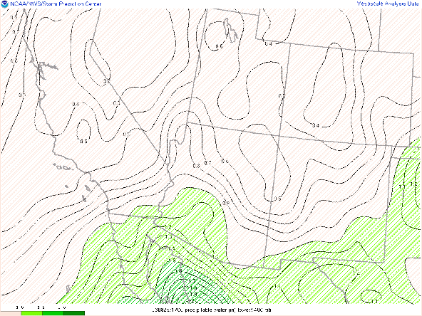
SPC Mesoanalysis has pwats of 2 inches or more in far southwestern AZ and southeastern CA with pwats decreasing rapidly eastward.
 |
| SPC Mesoanalysis of pwat as of 17:00z this morning. |
Today's Forecast
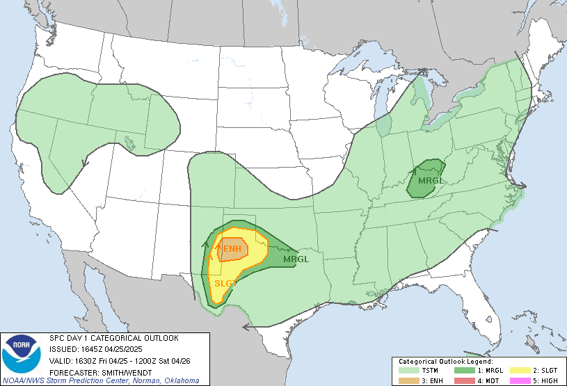
The SPC severe weather outlook today has the lower Colorado river valley in a slight risk for severe storms today and a marginal risk across most of Arizona.
 |
| SPC Day 1 Outlook. |
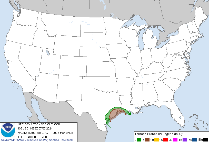
The main hazard today is a slight chance for a couple tornadoes with SPC forecasting a 5% chance in the Lower Colorado River Valley and southeastern CA.
 |
| SPC Day 1 Tornado Outlook. |
Of course 5% is a very low probability, but for Arizona this is very rare! However, based on hodographs from model soundings, low level helicity isn't nearly as impressive as it was forecast yesterday. The area of most concern for tornadoes in my opinion will be west of the Colorado River in southeastern CA.
Southeastern CA and southwestern AZ will remain under the influence of upper level speed divergence due to the jet max over the Great Basin.
 |
| 12z GFS 300mb winds at 5:00 PM MST. |
Moisture
There will be plenty of deep moisture today with the WRF forecasting pwats between 1.75 and 2.25 inches across most of Arizona with the highest amounts farther west.
 |
| 15z WRF-HRRR total precipitable water for today at 3:00 PM MST. |
Instability
Model soundings in Tucson, Phoenix, and Yuma only showing around 400 J/kg of CAPE by the middle of the afternoon which isn't very impressive.
| 12z KPHX WRF-HRRR sounding at 2:00 PM MST today. |
| 12z KTUS WRF-HRRR sounding at 3:00 PM MST today. |
| 12z KNYL WRF-HRRR sounding at 1:00 PM MST today. |
Vertical Wind Profiles
Hodographs are a bit confused by this afternoon in Tucson and Phoenix with strong backing winds below 500mb and weak veering above 500mb. Backing winds are an indicator of synoptic scale descent so this could work against storm development today. Better vertical wind profile in Yuma and in southwestern AZ where clockwise turning hodographs (particularly in the lower levels) and some weak instability could support a few isolated supercells and even a brief tornado or two.
What to Expect
Enough moisture, instability, and synoptic scale ascent should be enough for scattered showers and thunderstorms across Arizona today. The 12z and 15z WRF-HRRR forecast storms developing this afternoon where a few could be severe with strong, damaging winds and heavy rainfall.
The 15z WRF-HRRR has most of the precip remain over the higher terrain today with 1 to 2 inches possible over the Mogollon Rim with locally higher amounts possible.
15z WRF-HRRR total Precipitation between 8:00 AM MST this morning and 10:00 PM MST tonight.
The 12z WRF-HRRR does show some showers and storms in Tucson and Phoenix late tonight between 9:00 PM and 7:00 AM MST tomorrow as models are forecasting some upper level diffluence over Arizona tonight into tomorrow morning.
 |
| 12z WRF-HRRR simulated reflectivity for tonight at 10:00 PM MST. |
12z WRF-HRRR simulated reflectivity for tonight at 12:00 AM MST tomorrow.
 |
| 12z WRF-HRRR simulated reflectivity for tonight at 2:00 AM MST tomorrow. |
12z WRF-HRRR simulated reflectivity for tonight at 4:00 AM MST tomorrow.
12z WRF-HRRR simulated reflectivity for tonight at 6:00 AM MST tomorrow.
The WRF only shows Precipitation in Phoenix and Tucson to range between 0.1 and 0.2 inches. Storms will be moving rather quickly, but considering the high pwats and if storms train over an area flash flooding is a possibility but the chance looks to be on the lower end. The areas of most concern for flash flooding and debris flows will be over the higher terrain.
 |
| 12z WRF-HRRR total Precipitation between 5:00 AM MST this morning and 6:00 AM MST tomorrow. |


Comments
Post a Comment