August 5th: Hot, Dry Conditions Today & Tomorrow, Return of Moisture and Thunderstorm Activity Next Week
Synopsis
Arizona will remain abnormally dry and hot today and tomorrow due to the close proximity and strength of the mid level anticyclone. Excessive heat conditions will most likely continue through Monday, but a cool down is expected starting early next week. The combination of southerly flow aloft and a weak tropical cyclone in the eastern Pacific will lead to an increase in moisture and thunderstorm chances next week as well.
Current Conditions
Current SPC 500mb and 300mb analysis this morning displays the 500mb high anchored over south-central New Mexico and an upper level jet streak over the west-central CONUS.

SPC 500mb Analysis at 17:00Z this morning. 
SPC 300mb Analysis at 17:00Z this morning.
This upper level pattern promotes extreme synoptic scale subsidence due to the close proximity of the 500mb anticyclone as well as being in the right exit region of the jet streak (upper level convergence). This is reflected quite well in the 12z TUS sounding this morning as two subsidence inversions associated with these synoptic scale features are detected near 500mb and 250mb as shown below.

12Z TUS Sounding courtesy of SPC.
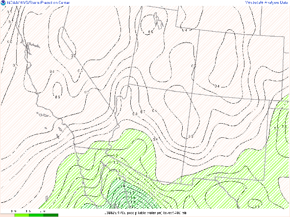
It definitely feels strange analyzing the influence of an upper level jet streak on our region in early August, but this just highlights the bizarre nature of our monsoon season this year. Other than the unfavorable upper air pattern, it is also still very dry across our region with 0.96 in of pwat and a morning dew point of 47 degF in Tucson. Overall, our atmosphere is currently hot, very stable, and moisture starved.
Another thing to mention is the tropical disturbance in the Eastern Pacific that has been mentioned in the past couple of discussions has now developed into a tropical depression this morning (Tropical Depression Six-E). Will discuss the impacts from this feature on our region later in the discussion.
 |
| Forecast storm track of Tropical Depression Six-E courtesy of the NHC. |
Today and Tomorrow
With a dry, stable environment in place today, the focus remains on excessive heat conditions across the lower deserts of Arizona. Models forecast high temps today to be just below 110 degF in Tucson, and between 110 degF and 113 degF between Phoenix and Yuma.
12Z WRF-HRRR 2-meter temps today at 4:00 PM MST.
Tomorrow, the 500mb anticyclone will strengthen to 598 dm and be centered near south-central New Mexico. A shortwave moving through the Pacific Northwest will continue to prevent the ridge from building northward.

GFS 500mb heights and vorticity for tomorrow at 18Z.
Also, with Tropical Depression Six-E passing by the tip of the Baja Peninsula over the next couple of days, a FULL Gulf of California moisture surge is expected to develop starting overnight tonight and persisting into Monday morning.
 |
| 12Z WRF-GFS total precipitable water tomorrow at 11:00 AM MST |
To illustrate how this phenomena occurs, I've provided a schematic below.
 |
| Schematic of the Gulf of California moisture surge phenomena adapted from Adams & Comrie 1997. |
The 12z WRF-HRRR forecasts pwats to slowly increase throughout the day tomorrow with pwats around an inch at 5:00 AM MST for areas in and west of Tucson and then increasing to around 1.25 in or more by 8:00 PM MST.
 |
| 12Z WRF-HRRR total precipitable water for tomorrow at 5:00 AM MST. |

12Z WRF-HRRR total precipitable water for tomorrow at 8:00 PM MST.
Even with 500mb heights increasing by tomorrow afternoon, the increase in moisture is expected to knock temps down a couple degrees especially in areas near the International Border. Am still expecting daytime maximum temps to reach near 110 degF between Phoenix and Yuma with temps in the Tucson area peaking around 105 degF.

12Z WRF-HRRR 2-meter temps for tomorrow at 3:30 PM MST.
There is sufficient consensus in the deterministic and ensemble runs of the GFS and ECMWF regarding the synoptic pattern for next week. The 500mb high will remain centered at 598 dm near south-central New Mexico on Monday and then will begin to weaken on Tuesday and Wednesday as well as becoming centered farther south and east near western Texas. This will cause 500mb heights to fall and put us under southerly flow aloft by Wednesday.

12Z GFS 500mb heights and vorticity for Monday at 18Z.
 |
| 12Z GFS 500mb heights and vorticity for Tuesday at 18Z. |

12Z GFS 500mb heights and vorticity for Wednesday at 18Z.
Need to wait until tomorrow when CAMs are in range to start discussing the mesoscale details, but for now expect temperatures to cool off as well as an increase in moisture and thunderstorm activity throughout next week. Stay tuned!!


Comments
Post a Comment