August 21st: Strong Thunderstorms Possible Today across southeastern and south-central AZ
Synopsis
Sufficient moisture and instability combined with synoptic scale lift will lead to several showers and thunderstorms this afternoon and evening across southeastern and south-central AZ (including Tucson and Phoenix). Some storms could be severe with gusty outflow winds, heavy rain, and even nickel to quarter sized hail.
Current Conditions
Visible imagery this morning displays a stream of clouds across Central Arizona with a few embedded showers moving briskly to the north.
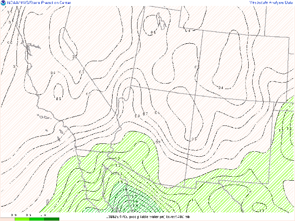
Hillary, now a remnant low over the Great Basin, has left a moist legacy airmass over Arizona this morning. SPC Mesoanalysis has pwats between 1.25 and 1.60 in and surface observations reporting dew points across Southern Arizona in the upper 60s with even a few locations reaching 70 degF!
 |
| SPC Mesoanalysis of precipitable water as of 17z this morning. |
 |
| Surface Observations as of 10:00 AM MST this morning courtesy of the NWS. |
A very impressive thermodynamic profile in Tucson this morning with the 12z TUS sounding measuring pwat of 1.78 in, a surface dewpoint of 70 degF, and 2050 J/kg of CAPE.
 |
| 12z TUS sounding courtesy of the SPC. |
Today's Forecast
Synoptics
Arizona will remain between two large synoptic scale features today with a trough over the west coast and a large, high amplitude ridge over the Great Plains. With a 600dm 500mb high over the Great Plains and a 578 dm trough over the west coast, a strong height gradient will produce brisk southerly mid level winds today across Arizona. This trough will lift northward throughout the day today and considering there is a bit of negative tilt to the trough axis, a bit of cyclonic vorticity advection throughout the day will also act as some upper level support for storm development.

12z GFS 500mb absolute vorticity at 5:00PM MST today.

12z GFS 300mb winds for today at 5:00PM MST.
WRF forecasts sufficient thermodynamic conditions in Tucson this afternoon with pwat at 1.67 in and CAPE of 948 J/kg. Once again though, WRF forecast a surface dew point at 11:00 AM MST of 61 degF and as of 11:00AM dew points are in the upper 60s across the metro via surface obs. Therefore, I am expecting CAPE this afternoon to be higher than what is forecast with CAPE most likely reaching around 1500 J/kg by this afternoon in Tucson. WRF also showing a decent vertical wind profile with veering winds in the mid levels.
| 12z KTUS WRF-HRRR sounding for today at 1:00 PM MST. |
Similar conditions in Phoenix this afternoon and evening with the WRF forecasting pwat at 1.82 in and CAPE just below 1000 J/kg. Similar situation though as WRF is currently under forecasting the surface dew point, so am expecting CAPE to be higher than WRF is forecasting.
| 12z KPHX WRF-HRRR sounding for today at 4:00 PM MST. |
What to Expect/Potential Impacts
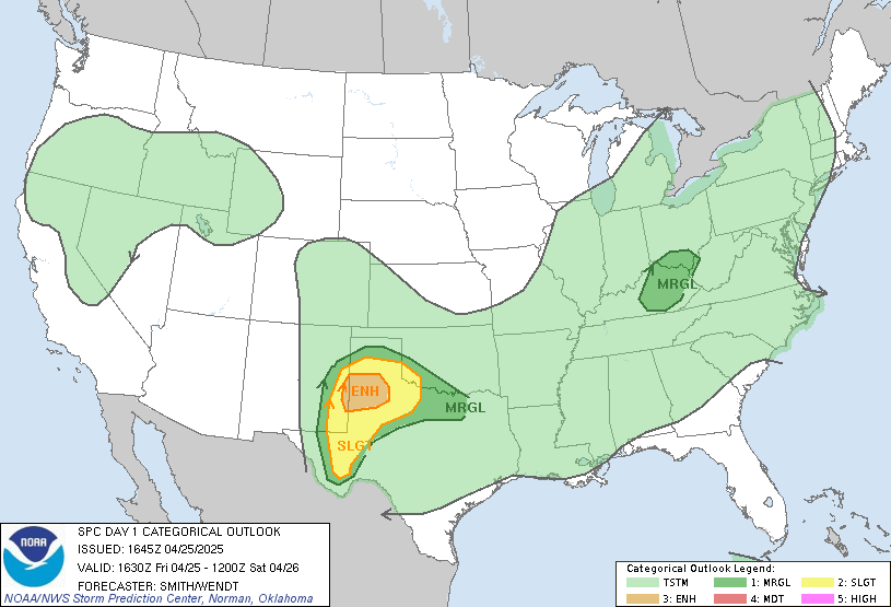
Sufficient thermodynamics combined with synoptic scale ascent will support strong thunderstorm clusters today across the lower deserts of southeastern and south-central AZ. This has prompted the SPC to issue a marginal risk for severe storms today.
 |
| SPC Day 1 Outlook. |
Speed shear and even a bit of directional shear (indicated by slight clockwise turning hodographs) will likely support strong storm clusters between Tucson and Phoenix today. Considering CAPE over 1000 J/kg and a bit of veering in the mid levels, wouldn't be surprised to see some cells rotate today. The main threat will be gusty outflow winds, blowing dust, and even some severe grade hail especially considering the higher levels of CAPE. With brisk southerly steering flow, storm clusters will be moving quite rapidly today, but the 12z and 15z WRF indicate a couple rounds of storms in Tucson throughout the afternoon and evening which with plentiful amounts of low level moisture could lead to some flooding concerns in the Tucson metro this evening. The 12z and 15z WRF are forecasting between 0.4 and 0.5 inches of total precipitation between 1:00PM and 5:00 PM MST this afternoon in Tucson.
Am going to use the 12z WRF-HRRR to show the expected evolution of storms today.
Storms are expected to initiate over Mt. Lemon and just south of the Tucson metro early this afternoon.
| 12z WRF-HRRR Tucson Region Station Plots and simulated reflectivity at 1:00 PM MST. |
With plenty of moisture, CAPE, and synoptic scale ascent storms will rapidly develop over the metro early this afternoon.
| 12z WRF-HRRR Tucson Region Station Plots and simulated reflectivity at 2:00 PM MST. |
A second round of stronger storms is forecast to impact the Tucson metro during the early evening hours.
| 12z WRF-HRRR Tucson Region Station Plots and simulated reflectivity at 5:00 PM MST. |
| 12z WRF-HRRR Tucson Region Station Plots and simulated reflectivity at 6:00 PM MST. |
| 12z WRF-HRRR Tucson Region Station Plots and simulated reflectivity at 7:00 PM MST. |
Storm clusters will continue to move northward toward Phoenix along the I10 corridor throughout the afternoon and into the evening hours. WRF forecasts storms to reach the Phoenix metro this evening, most likely after sunset.
| 12z WRF-HRRR Phoenix Region Station Plots and simulated reflectivity at 7:00 PM MST. |
| 12z WRF-HRRR Phoenix Region Station Plots and simulated reflectivity at 8:00 PM MST. |
| 12z WRF-HRRR Phoenix Region Station Plots and simulated reflectivity at 9:00 PM MST. |
| 12z WRF-HRRR Phoenix Region Station Plots and simulated reflectivity at 10:00 PM MST. |
| 12z WRF-HRRR Phoenix Region Station Plots and simulated reflectivity at 11:00 PM MST. |
In summary, a very active day is in store for Tucson and Phoenix this afternoon and evening with hazardous driving conditions likely along the I10 between Tucson and Phoenix. Some storms could be severe with gusty, damaging winds, blowing dust, heavy rain, and even some severe grade hail possible.


There is a problem when looking at old forecast discussions-they appear to be using real time links thus are displaying current maps rather than the maps from the day in question. No good if one wants to go back and check out old discussions!
ReplyDeleteThe problem is with the WRF model plots only.
Delete