August 6th: Chances for Thunderstorms Return This Week
Synopsis
Moisture from the south will continue to increase across our region throughout the day today and into tomorrow morning. With increasing moisture today, high temperatures are forecast to be a couple degrees cooler compared to yesterday with temps around 105 degF in Tucson and just below 110 degF between Phoenix and Yuma. There is a slight chance for a couple isolated thunderstorms near the International Border in southeastern Arizona for this afternoon and evening as well. Starting tomorrow, conditions will become more favorable for convection across the region with chances for showers and storms increasing throughout the week.
Current Conditions
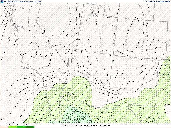
GOES derived precipitable water and surface observations displayed moisture creeping up into southern Arizona this morning from the south as anticipated. Surface dew points have sky-rocketed over the past few hours with dew point temperatures increasing by 20 degF between 4:00 AM MST and 9:00 AM MST at the Tucson International Airport!
 |
| GOES derived total precipitable water this morning courtesy of College of Dupage. |
Surface Observations this morning at 10:35 AM MST courtesy of the NWS.
 |
| Surface Observations at the Tucson International Airport this morning courtesy of the NWS. |
 |
| 12z TUS sounding courtesy of the SPC. |
The main feature of interest is the subsidence inversion around 500mb due to the strength and close proximity of the mid level anticyclone. This capping inversion will play a critical role in any potential convective development today.
 |
| SPC 500mb analysis at 17:00Z this morning. |
Today's Forecast
The 500mb anticyclone centered near southern New Mexico is still expected to reach maximum strength at 598 dm this afternoon which should maintain the synoptic scale subsidence in the mid levels throughout the day. All runs of the WRF show a couple of cells developing over the highest terrain in Santa Cruz and far southern Cochise counties this evening with the 12z WRF-HRRR seeming to be the most realistic solution as shown below.
12z WRF-HRRR simulated maximum reflectivity for this evening at 6:00 PM MST.
With the added moisture, maximum temperatures will be a few degrees cooler today with temperatures expected to reach around 105 degF in Tucson and at or just below 110 degF in the lower deserts between Phoenix and Yuma.
12z WRF-HRRR 2-meter temps at 4:00 PM MST.
Models forecast precipitable water to increase drastically by tomorrow morning with pwats between 1.25 in and 1.50 in around sunrise which is more typical for this time of year based on climatology.
12z WRF-HRRR total precipitable water at 5:30 AM MST tomorrow.
 |
| 12z GFS 300mb heights and winds for tomorrow at 18Z. |
 |
| 12z GFS 500mb heights and vorticity for tomorrow at 18Z. |
At the same time the 12z WRF-HRRR KTUS model sounding forecasts plenty of moisture and instability by tomorrow afternoon with forecast pwat of 1.66 in and MUCAPE of 1687 J/kg at 4 PM MST.
 |
| 12z KTUS WRF-HRRR sounding for tomorrow at 4:00 PM MST. |
What really looks to be the biggest forecast variable tomorrow is debris clouds from overnight convection in Sonora that are forecast to move through our region throughout the day tomorrow. With plenty of CAPE, moisture, and even some synoptic scale ascent it would appear that tomorrow looks to be a great day for widespread storms, however these debris clouds are likely to be the primary inhibitor for convective development. This is reflected in the 12z WRF-HRRR simulated reflectivity and outgoing long wave radiation plots as shown below.
12z WRF-HRRR simulated maximum reflectivity at 4:00 PM MST.
 |
| 12z WRF-HRRR Outgoing Longwave Radiation at 4:00 PM MST |
With the added moisture and even some scattered cloud cover, temperatures will likely be cooler tomorrow compared to the past few days especially in southeastern Arizona with daytime highs around 100 degF in Tucson. However, temperatures between Phoenix and Yuma will likely range between 105 degF and 110 degF depending on the amount of cloud cover.
12z WRF-HRRR 2-meter temps for tomorrow at 4:00 PM MST.
Overall, the biggest question mark tomorrow will be the extent of debris clouds across our region. The amount of cloud cover will significantly impact high temperatures as well as thunderstorm development. Albeit, an increase in moisture and thunderstorm chances is expected tomorrow with storms mainly remaining south and east of Tucson. Again, will need to monitor this closely as small variations in the amount of cloud cover will play a critical role tomorrow.
Tuesday through Friday
Had to spend a decent amount of time this morning focusing on the forecast for tomorrow. A Cliff Notes version for Tuesday through Friday is cooler temps and increases in storm chances.
The ridge appears to weaken significantly by Tuesday with models forecasting 500mb heights to lower to around 592 dm and mid level flow becoming more southerly. Models are also hinting at a couple of weak waves moving northward from Sonora Thursday and Friday so definitely something to keep an eye on. As stated the past few days, stay tuned!!


Comments
Post a Comment