September 14th: Isolated Showers and Storms Possible in Southeastern AZ Today
Synopsis
Active day yesterday afternoon with numerous showers and strong thunderstorms across Southeastern AZ. Precipitable water has plummeted overnight as westerly flow aloft today will continue to rapidly dry out our atmosphere. Still, should be just enough remnant low level moisture and some weak instability for a few isolated showers and low-topped thunderstorms mainly over the high terrain south and east of Tucson.
Current Conditions
Hope everyone enjoyed the storms the last few days as that was likely the 2023 Monsoon Season Farewell Event. Widespread showers and thunderstorms yesterday across Southeastern Arizona, mainly from Tucson eastward with some storms producing wind gusts of 40 to 50 mph and penny to nickel sized hail. Not a ton of accumulated rainfall yesterday with most locations in the Tucson metro receiving around 0.10 in or less, but Tucson International Airport received the strongest thunderstorm with 0.33 in measured.
SPC 500mb and 300mb analysis this morning displays an upper level trough over the Desert Southwest and a weak 300mb speed max stretching from Southeastern AZ to Northwestern Texas.
SPC 500mb analysis as of 17:00z this morning.
SPC 300mb analysis as of 17:00z this morning.
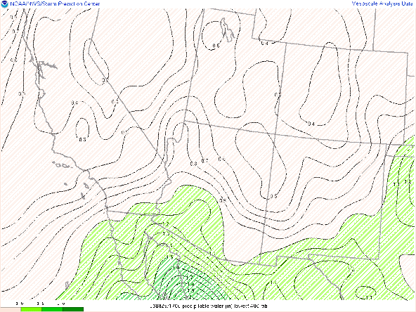
Meanwhile, atmospheric moisture has plummeted significantly overnight due to westerly flow aloft transporting dry air into Arizona via GOES derived precipitable water this morning.

Visible imagery overlaid with GOES derived total precipitable water this morning courtesy of the College of Dupage.
The 12z TUS sounding also reflecting the dry mid and upper levels with only 1.15 in of pwat measured. The instability is a bit misleading with around 1000 J/kg of CAPE, but notice the messy temperature and dew point profiles in the low levels.
 |
| 12z TUS sounding courtesy of the SPC. |
Continued drying combined with mixing of the boundary layer will lead to rapidly deteriorating thermodynamic conditions throughout the day today.
Today's Forecast
Synoptics
Unlike yesterday, today Southeastern Arizona will be in the left entrance region of the 300mb speed max which will provide the region with synoptic scale descent due to upper level convergence.

GFS 300mb wind speed for this afternoon at 5:00 PM MST.
 |
| GFS 500mb Relative Humidity for this afternoon at 5:00 PM MST. |
Moisture and Instability
Moisture will continue to decrease with the 12z WRF-HRRR forecasting pwats less than 1 inch across the entire state by late this afternoon.
12z WRF-HRRR total precipitable water for this afternoon at 5:00 PM MST.
With rapidly deteriorating thermodynamic conditions today, the best chance for storms will be early this afternoon when instability will be maximized. The 12z KTUS WRF-HRRR sounding forecasts a maximum of around 400 J/kg by early this afternoon in the Tucson vicinity with pwat of just below an inch.

12z KTUS WRF-HRRR sounding for this afternoon at 1:00 PM MST.
 |
| 12z KTUS WRF-HRRR sounding for this afternoon at 5:00 PM MST. |
What to Expect
With synoptic scale subsidence/descent combined with deteriorating thermodynamic conditions, expect minimal storm coverage today. Best chances will remain south and east of Tucson where slightly better instability combined with differential heating will be just sufficient enough for isolated showers and low-topped thunderstorms. Best chances for storms will be early in the afternoon when instability will be maximized. Cannot completely rule out a shower or low-topped cell in the Tucson vicinity this afternoon but the chance is less than 10% at this time. Considering the drying low levels, DCAPE will increase rapidly this afternoon so any cell that does develop will be able to produce locally gusty winds. Below is the 12z WRF-HRRR forecast for storms today.
12z WRF-HRRR simulated maximum reflectivity for this afternoon at 2:00 PM MST.
12z WRF-HRRR simulated maximum reflectivity for this afternoon at 3:00 PM MST.
 |
| 12z WRF-HRRR simulated maximum reflectivity for this afternoon at 4:00 PM MST. |
Mid level heights between 584 and 586 dm will provide the lower deserts with relatively comfortable temperatures this afternoon with temps in the low 90s in the Tucson vicinity and temps around 100 degF between Phoenix and Yuma.
12z WRF-HRRR 2-meter temps for this afternoon at 4:00 PM MST.


Comments
Post a Comment