September 15th: Tranquil Conditions this Weekend; Most likely Dry and Cooler the Rest of September
Synopsis
Very, dry and stable atmosphere indicated by the 12z sounding this morning due to westerly flow aloft. Expect dry and warm weather across the lower deserts today through Sunday. There is a chance of showers and storms near the AZ/NM Border on Sunday, but activity is expected to remain well east of Tucson and Phoenix. This will likely be the last discussion of the 2023 Monsoon Season as medium and long-range deterministic and ensemble guidance suggests mostly dry conditions through the rest of September.
Current Conditions
Current SPC 500mb analysis displays a shortwave trough over the Central Rockies, a high amplitude ridge over the West Coast, and zonal flow over Arizona.
SPC 500mb analysis as of 18:00Z this morning.
 |
| 12z TUS Sounding courtesy of the SPC. |
Today Through Sunday
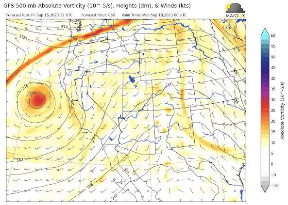
The high amplitude ridge over the west coast will slowly build eastward into Arizona this weekend increasing mid level heights and still maintaining mostly dry and stable conditions across Arizona with the exception being the high terrain near the AZ/NM Border on Sunday. Of course, with increasing mid level heights leads to increasing surface temperatures, but temps will likely remain well-below excessive heat criteria this weekend in the lower deserts.

12z GFS 500mb absolute vorticity for tomorrow at 5:00 PM MST.
 |
| 12z GFS 500mb absolute vorticity for Sunday at 5:00 PM MST. |
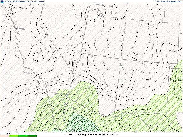
There will be a slight increase in pwats over the AZ/NM Border on Sunday which combined with upper level divergence will generate showers and thunderstorms from the AZ/NM Border eastward into New Mexico.
12z WRF-HRRR simulated maximum reflectivity for Sunday at 3:00 PM MST.
Otherwise, expect dry and warm conditions this weekend across the lower deserts with temps in the upper 90s in the Tucson vicinity and at or just above 100 degF between Phoenix and Yuma.
12z WRF-HRRR 2-meter temps for today at 4:00 PM MST.
12z WRF-HRRR 2-meter temps for Saturday at 4:00 PM MST.
12z WRF-HRRR 2-meter temps for Sunday at 4:00 PM MST.
Deterministic and Ensemble guidance is in good agreement that Arizona will remain under dry, westerly/southwesterly flow aloft through the rest of the month. This is also backed up by the Climate Prediction Center's 6-10 and 8-14 Day Outlooks which forecasts Arizona to remain dry and somewhat on the cooler side for the next couple of weeks.
CPC 6-10 Day Temperature and Precipitation Outlook.
 |
| CPC 8-14 Day Temperature and Precipitation Outlook. |
With this in mind, most likely the 2023 Monsoon Season has ended, so this will probably be the final discussion of the season. Eyad and I have enjoyed writing these discussions this summer and we hope these discussions have provided proficient forecast information. Feedback is highly encouraged as we would like to continue improving these discussions for the next Monsoon Season in 2024.


Thank you.
ReplyDelete