September 8th: Hot and Mostly Dry this Weekend; Potential for Increasing Storm Activity Next Week
Synopsis
The mid level anticyclone will amplify today and tomorrow, and remain in close proximity to Southern Arizona through Sunday providing Arizona with dry, stable, and hot conditions this weekend. Any storm development will remain isolated and mainly confined to the higher terrain and near the International Border. Hurricane Jova, currently centered several hundred miles west of southern Baja, will continue to weaken over the next few days. By early next week, the deterministic GFS and ECMWF as well as their ensemble members are in good agreement that remnant moisture associated with Jova will be transported in the westerlies and move through the Desert Southwest bringing an increase in moisture, cooler temps, and potentially an uptick in shower and storm chances across Arizona.
Current Conditions
Visible imagery this morning displays numerous mid level clouds and even a few embedded light showers across southeastern Arizona.
 |
| Visible Imagery this morning as of 16:20z courtesy of the College of Dupage. |
 |
| 12z TUS sounding courtesy of the SPC. |
 |
| 12z PHX sounding courtesy of the SPC. |
The low levels are still very dry however with dew points in the 40s leading to nearly no buoyancy with MUCAPE just around 100 J/kg across most of Southern Arizona.
Meanwhile, current SPC 500mb analysis this morning displays the mid level anticyclone centered at 594 dm over Southern New Mexico with weak southerly flow across southeastern AZ.
 |
| SPC 500mb analysis as of 16:00z this morning. |
A thin layer of smoke is also evident in the northeast Tucson area due to the Molino 3 Fire which started yesterday evening over the Catalina Foothills. The Molino Fire is currently at ~100 acres and at 0% containment according to the Coronado National Forest as of 9:31 AM MST.
U AZ Hydrology and Atmospheric Science Department web cam pointing north towards the Santa Catalina Mountains as of 9:49 AM MST.
Today through Sunday
Regarding the smoke from the Molino 3 Fire, smoke should slowly mix out throughout the day today and predominantly westerly winds should keep most of the smoke to the northeast of the Tucson metro.
Synoptics
The mid level anticyclone will remain centered over Southern New Mexico today with weak southerly flow across southeastern Arizona. By tomorrow the ridge will shift slightly westward and be centered directly over southeastern Arizona. This will lead to hotter temperatures as well as maintain a dry and stable thermodynamic environment.
 |
| 12z GFS 500mb absolute vorticity for tomorrow at 11:00 AM MST. |
 |
| 12z GFS 500mb absolute vorticity for Sunday at 11:00 AM MST. |
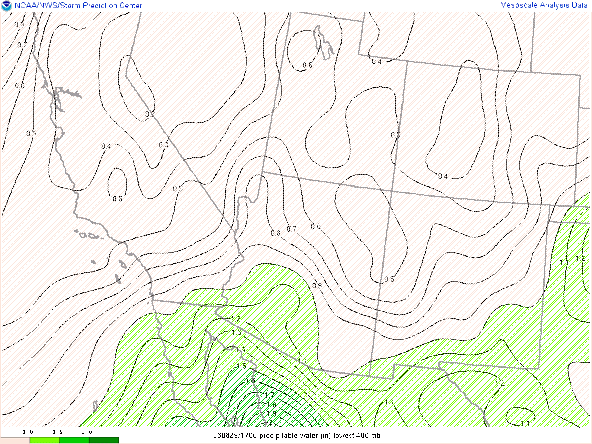
The better moisture will remain confined to far Southwestern AZ today where moisture from the Gulf of California has provided that region with pwats near 1.25 in this morning. The 12z WRF-HRRR forecasts pwats to remain around an inch or less in Southeastern AZ throughout the day today.
12z WRF-HRRR total precipitable water for this afternoon at 4:00 PM MST.
12z WRF-HRRR total precipitable water for tomorrow afternoon at 4:00 PM MST.
Westerly flow aloft on Sunday will maintain these below average pwat values as well.
12z WRF-HRRR total precipitable water for Sunday afternoon at 4:00 PM MST.
With very limited moisture combined with synoptic scale subsidence induced by the close proximity of the mid level anticyclone, instability will be nearly nonexistent. There still should be just barely enough moisture and instability combined with differential heating for a few isolated short-lived thunderstorm over the highest mountain peaks and near the International Border today through Sunday. Also, just like this morning, overnight mid level clouds with embedded light showers are possible this weekend across the region, but don't expect anything more than a few annoying sprinkles and virga. Otherwise, it will be a quiet weekend across Arizona with the main focus on the extreme heat.
Maximum Temperatures
Dry low levels combined with the close proximity of the 594 dm high will provide the lower deserts with above average temperatures today through Sunday. Today, expect temps just above 100 degF in the Tucson vicinity, and temps in the lower deserts between Phoenix and Yuma in the 105 to 108 degF range.
12z WRF-HRRR 2-meter temps for today at 4:00 PM MST.
12z WRF-HRRR 2-meter temps for tomorrow at 4:00 PM MST. 12z WRF-HRRR 2-meter temps for Sunday at 4:00 PM MST.
Early Next Week
Monday through Wednesday, the mid level anticyclone will be centered to our south/southwest putting Arizona on the northern periphery of the ridge leading to zonal flow aloft. Embedded in the zonal flow will be a series of weak shortwaves that will move through Arizona Monday through Wednesday.

12z GFS 500mb analysis for Monday at 11:00 AM MST.
 |
| 12z GFS 500mb analysis for Tuesday at 11:00 PM MST. |

12z GFS 500mb analysis for Wednesday at 11:00 PM MST.
This pattern will also help transport moisture into Arizona from the remnants of current Hurricane Jova as shown below.

12z GFS total precipitable water for Monday at 11:00 AM MST. .jpg)
12z GFS total precipitable water for Tuesday at 11:00 AM MST.
.jpg)
12z GFS total precipitable water for Wednesday at 11:00 AM MST.
Synoptic scale lift induced by these embedded shortwaves combined with the increasing moisture could provide southeastern Arizona with an increase in showers and thunderstorms early next week. There is still a lot of uncertainty regarding timing, coverage, and intensity of potential precipitation. For now, we can at least expect an increase in moisture, cooler temperatures, and the potential for an uptick in shower and thunderstorm activity across southeastern AZ Monday through Wednesday of next week. This discussion will be valid through Sunday, so by Monday CAMs will be in range to provide a much more certain forecast regarding this event. Stay tuned!


Comments
Post a Comment