February 28th, 2024: Quick Update for Today's Forecast
Synopsis
A relatively busy weather day is in store for Southern AZ as a closed low moves through the region bringing widespread convective showers and a few thunderstorms. Main impacts will be brief, locally heavy rainfall, occasional lightning strikes, and gusty winds.
Current Conditions
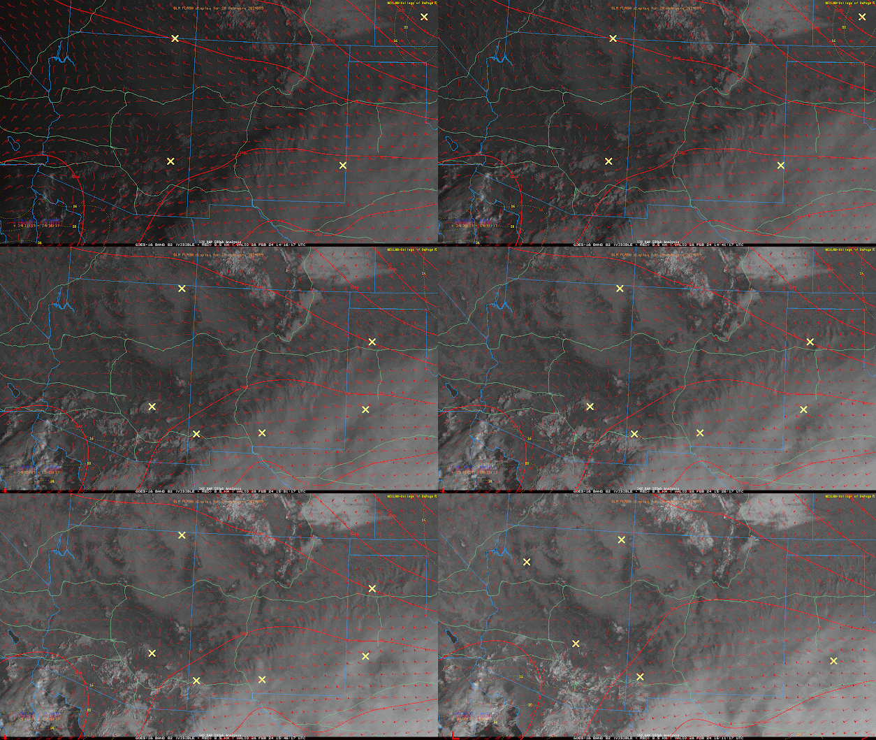
The aforementioned closed low is knocking on the door and currently centered over the far Northern Gulf of CA this morning as indicated by visible imagery overlaid with SPC 500mb analysis.
 |
| Visible imagery overlaid with GLM flashes and SPC 500mb RAP Analysis this morning. |
Scattered cumulus are also noted on this morning's visible imagery with a few showers and thunderstorms over the far Northern Gulf of CA.
This morning's 12z TUS sounding displayed 0.55in of pwat, around 100J/kg of MUCAPE, and decent shear (77 knots) from the surface to 8km.
 |
| 12z TUS Sounding courtesy of the SPC. |
Today's Update
Pockets of sunshine between these shallow, scattered cumulus this morning will be able to heat the surface and combined with cooling mid level temps will destabilize the atmosphere by early this afternoon. As I alluded to yesterday, the UA WRF tends to have a dry boundary layer bias. This appears to be the case today as the 12z KTUS WRF-HRRR sounding forecast a surface dew point of 39 degF at 9:00AM MST and 10:00AM MST as shown below.
 |
| 12z KTUS WRF-HRRR sounding for this morning at 9:00AM MST. |
I checked surface obs and dew points, as of 9:45AM MST, are in the mid 40s across the Tucson vicinity. Even though it's only a few degrees, this small difference is critical for evaluating the amount of CAPE today. The 12z KTUS WRF-HRRR sounding for this afternoon forecast a maximum of around 200 J/kg of CAPE, but am thinking CAPE will likely be more around the 500J/kg range by this afternoon considering the dry bias in the model.
 |
| 12z KTUS WRF-HRRR sounding for this morning at 12:00PM MST. |
Rainfall and snow QPF are still on track with no significant changes. Also, still a good chance for a few thunderstorms across Southern AZ that could produce brief, heavy rainfall, occasional lightning flashes/strikes, and gusty winds. The wind potential appears to be of most concern with the 12z HREF forecasting between a 50% and 70% probability of wind speeds in excess of 30 knots this afternoon and early evening.
12z HREF 4-hour max wind speeds and probability of wind speeds > 30 knots for today at 5:00PM MST.
12z HREF 4-hour max wind speeds and probability of wind speeds > 30 knots for today at 7:00PM MST.
The chance for hail is very remote, but still an outside chance for small hail in the strongest updrafts.
The rest of the forecast is on track. See yesterday's discussion for additional details.


Comments
Post a Comment