February 8th, 2024: Compact Shortwave to Impact Arizona Today
Synopsis
A shortwave embedded in the long wave trough pattern will impact Arizona today providing mainly light valley rain, mountain snow, and brisk southwesterly winds with the highest amounts remaining confined to Northern AZ.
Current Conditions
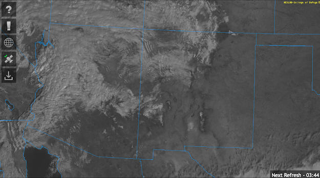
At 9:20AM MST, visible satellite imagery displayed a band of light to moderate showers extending across the western third of Arizona moving rapidly eastward.
GOES-16 visible satellite imagery at 9:20AM MST courtesy of College of Dupage.
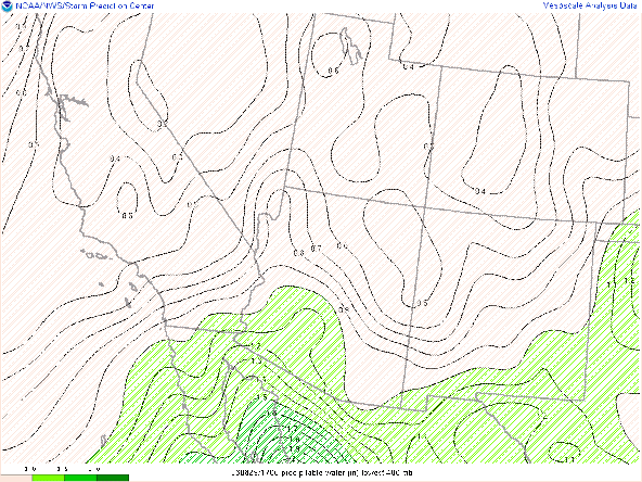
SPC 500mb analysis valid at 15:00Z.
WPC surface analysis this morning displays a cold front over western AZ which is associated with the band of showers in that region.

WPC Surface Analysis valid at 9:42AM MST.
The aforementioned shortwave over Western AZ/Southern NV will move rapidly eastward throughout the day today providing AZ with PVA inducing synoptic scale ascent.

06Z GFS 500mb absolute vorticity valid for this afternoon at 5:00PM MST.
The band of showers over Western AZ this morning is associated with a region of PVA ahead of the trough axis. This region of precipitation is expected to impact Phoenix by early this afternoon and eventually Tucson by around sunset.
12z WRF-HRRR simulated reflectivity for this afternoon at 12PM MST.
12z WRF-HRRR simulated reflectivity for this afternoon at 2PM MST.
12z WRF-HRRR simulated reflectivity for this afternoon at 4PM MST.
12z WRF-HRRR simulated reflectivity for this afternoon at 6PM MST.
12z WRF-HRRR simulated reflectivity for this afternoon at 8PM MST.
12z WRF-HRRR simulated reflectivity for this afternoon at 10PM MST.
Ahead of the cold front, brisk southwesterly winds can be expected with sustained winds of 15 to 25 knots with strongest winds over the higher terrain.
12z WRF-HRRR 10-meter winds for this afternoon at 1:00PM MST.
There is a very slight chance for a low-topped thunderstorm or two within this band of showers with the 12z KPHX and KTUS WRF-HRRR soundings indicating less than 100 J/kg of CAPE. However this buoyancy is confined to a shallow layer in the mid levels and below a strong inversion, so wouldn't expect anything more than a couple isolated lightning flashes, brief heavy rain, and small hail.

12z KPHX WRF-HRRR sounding for this afternoon at 3:00PM MST.

12z KTUS WRF-HRRR sounding for this afternoon at 5:00PM MST.
Rainfall amounts will be light with between a trace and 0.25 inch across the valleys between 0.10 and 0.50 inch along the southwestern facing slopes of the mountains with locally higher amounts possible in Northern AZ.
 |
| 12z WRF-HRRR 24-hour QPF from 12z this morning to 12z tomorrow morning. |
Snow levels will remain above 5000 feet with only an inch or two of snow expected over the Sky Islands and White Mountains, but upwards of 6 to 12 inches of snow over the higher terrain of Northern AZ (including Flagstaff).
12z WRF-HRRR 24-hour snowfall forecast from 12z this morning to 12z tomorrow morning.
A colder and slightly more dynamic shortwave is expected to impact our region this weekend bringing another round of valley rain and mountain snow. Still some details to be worked out, so stay tuned for a discussion tomorrow regarding this weekend's storm.


Comments
Post a Comment