March 6th, 2024: Chance for Valley Rain and Mountain Snow Thursday
Synopsis
A relatively weak Pacific Storm is expected to impact Arizona tomorrow bringing a chance of mainly light valley rain showers and high elevation snow. Marginal instability will promote a chance for an isolated low-topped thunderstorm or two as well. Rainfall amounts will range from a few hundredths of an inch to 1/3 inch across the lower deserts and between 0.1 and 0.5 inch over the higher terrain with highest amounts along the southwestern/western facing mountain slopes. Snow levels will remain above 6500 feet with 3 to 6 inches of accumulated snowfall with locally higher amounts possible mainly over the highest peaks of the Mogollon Rim and White Mountains.
Current Conditions
GOES-18 visible satellite imagery and GLM flashes this morning displays a mid latitude cyclone just west of Point Conception, and a stream of thick high clouds across Arizona.
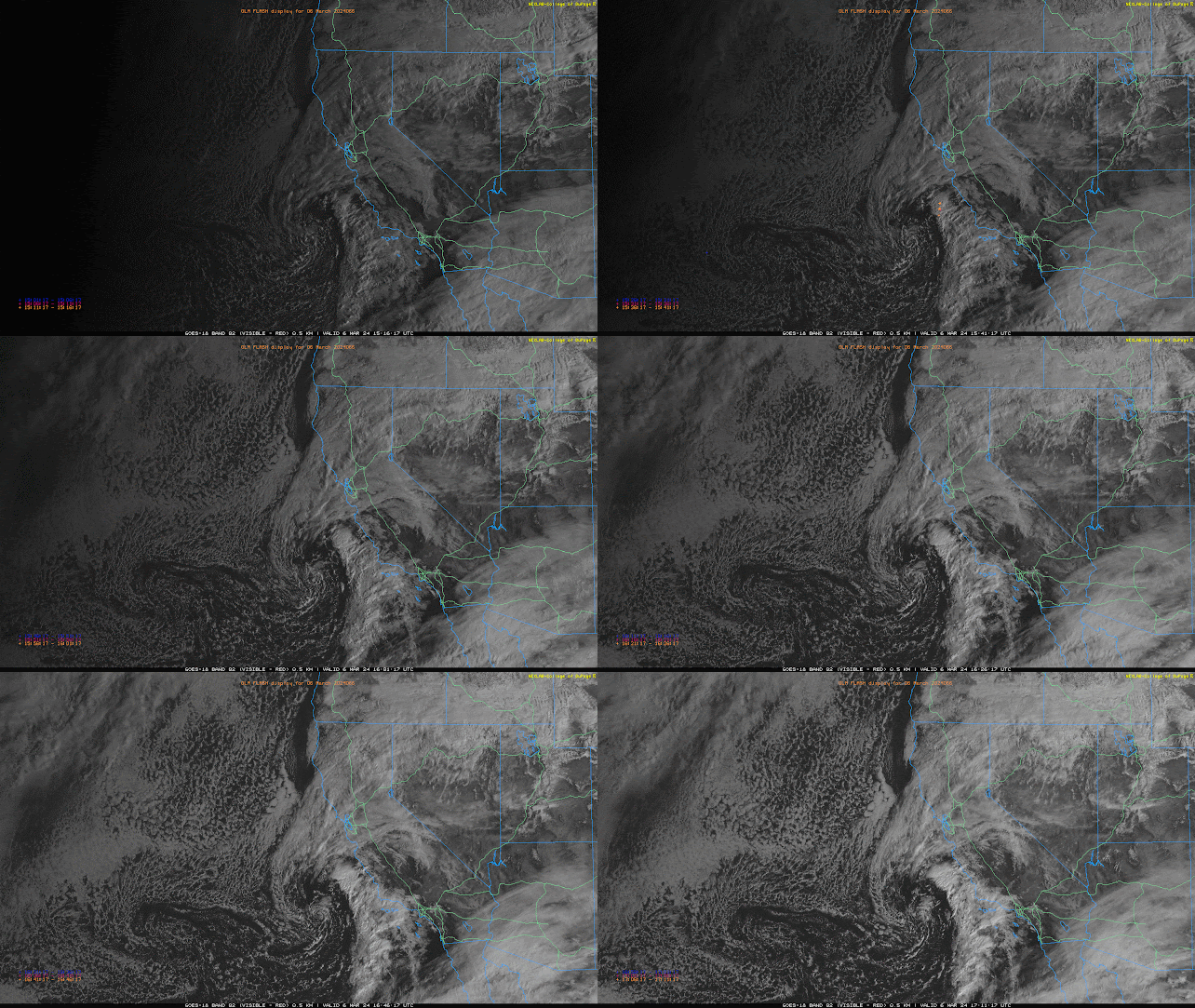
GOES-18 visible imagery overlaid with GLM flashes courtesy of College of Dupage.
SPC 300mb analysis as of 17z this morning.
The mid latitude cyclone off the SoCal coast is associated with left exit region upper level divergence and PVA ahead of an embedded shortwave within a broad mid level trough.
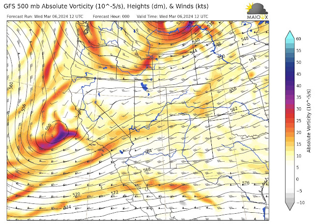
12z GFS 500mb analysis this morning.
This morning's 12z TUS sounding measured a very stable profile with only 0.31 in. of pwat, no CAPE, and a strong inversion at around 400mb, likely associated with warming due to condensation in the upper levels.
 |
| 12z TUS Sounding courtesy of the SPC. |
Today and Tonight
Throughout the day today and into this evening the aforementioned embedded shortwave and associated mid latitude cyclone will move east into SoCal.
 |
| 12z GFS 500mb absolute vorticity for this afternoon at 5:00PM MST. |
 |
| 12z GFS 500mb absolute vorticity for this evening at 11:00PM MST. |
Meanwhile, in AZ the thick blanket of high clouds will slowly move east throughout the afternoon and into tonight. At the surface, weak warm advection will keep temps in the low to mid 70s as well as breezy southwest winds (10 to 20 kts) across the lower deserts. High clouds will make their way out of AZ by late tonight with mostly clear conditions and low temps in the upper 40s to low 50s across lower elevations.
Tomorrow Morning through Friday Morning
Synoptics
By early tomorrow morning, the mid latitude cyclone will make its way into AZ. PVA ahead of the vort max of the shortwave and upper level divergence associated with the left exit region of the subtropical jet will induce synoptic scale ascent.
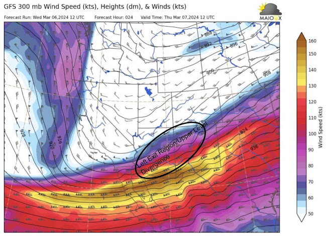
12z GFS 300mb winds for tomorrow at 5:00AM MST.
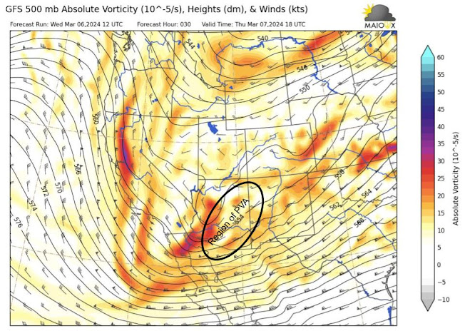
12z GFS 500mb absolute vorticity for tomorrow at 11:00AM MST.
However, the window for favorable synoptic scale support will be short-lived tomorrow for a couple of reasons. First, the shortwave is expected to lift (weaken) throughout the day and into the early evening. This is due to the jet streak being down stream of the vort max causing the trough to lift poleward and a consequent net loss of positive vorticity. Secondly, another shortwave diving rapidly southward embedded on the back side of the long wave trough will slightly amplify leading to shortwave ridging ahead of it which will cause heights to rise over AZ late tomorrow afternoon and early evening (recipe for subsidence aloft).
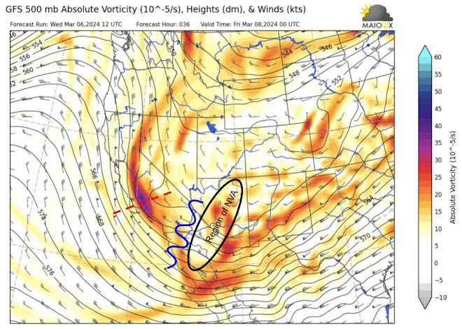
12z GFS 500mb absolute vorticity for tomorrow at 5:00PM MST.
This second shortwave is expected to move through far Southern AZ and Northern Mexico early Friday morning which should provide very weak PVA in those regions.
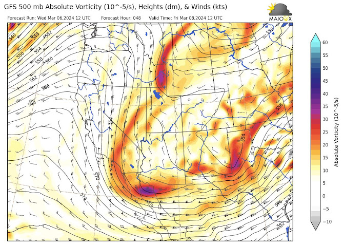
12z GFS 500mb absolute vorticity for Friday at 5:00AM MST.
Even with some weak PVA, AZ will be under the influence of weak cold advection as shown below with the 12z GFS 850mb temps.
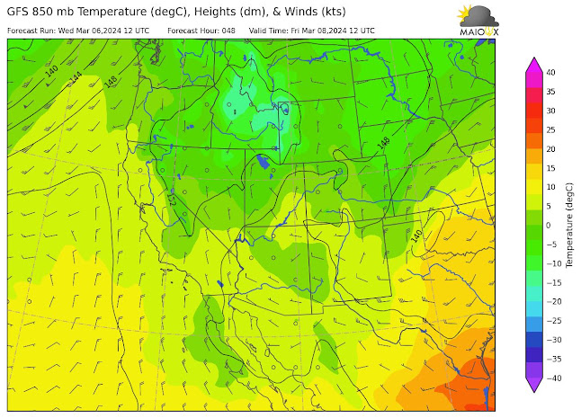
GFS 850mb temperatures for Friday at 5:00AM MST.
With PVA and cold advection in place for Friday morning, this generates some ambiguity as far as synoptic scale vertical motion is concerned. PVA induces ascent whereas cold advection induces descent from a QG perspective.
Moisture and Instability
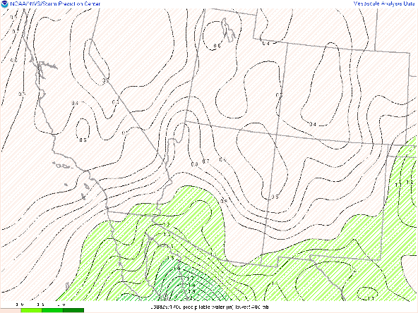
Only marginal amounts of moisture anticipated with this system as models only forecasting around 0.50 in of pwat tomorrow across the lower deserts.
12z WRF-HRRR total precipitable water for tomorrow at 11:00AM MST.
As mentioned above, the weakening shortwave and building transitory shortwave ridge will induce some subsidence aloft due to rising mid level heights which is reflected in the 12z KTUS and KPHX WRF-HRRR soundings for tomorrow afternoon as shown below.
 |
| 12z KPHX WRF-HRRR sounding for tomorrow at 3:00PM MST. |
 |
| 12z KTUS WRF-HRRR sounding for tomorrow at 4:00PM MST. |
This subsidence inversion will be the primary inhibitor of any deeper convection tomorrow and therefore maintain relatively low-topped showers. However, there will still be just enough instability in the low and mid levels below the inversion for a few heavier showers and even a low-topped thunderstorm or two.
What to Expect/Potential Impacts
Overall, this doesn't appear to be a high impact event based on current guidance at this time. The time frame for the best chance of valley rain and mountain snow appears to be tomorrow morning and early afternoon where the best synoptic scale support will be in place. Below is the 12z WRF-HRRR evolution of precipitation tomorrow.
12z WRF-HRRR simulated reflectivity for tomorrow at 5:00AM MST.
12z WRF-HRRR simulated reflectivity for tomorrow at 8:00AM MST.
12z WRF-HRRR simulated reflectivity for tomorrow at 11:00AM MST.
12z WRF-HRRR simulated reflectivity for tomorrow at 2:00PM MST.
12z WRF-HRRR simulated reflectivity for tomorrow at 5:00PM MST.
Showers will taper off rapidly from west to east throughout the late afternoon and into the evening hours. As the next shortwave moves through early Friday morning, a few scattered mainly light showers are possible across AZ as shown below.
12z WRF-HRRR simulated reflectivity for Friday at 4:00AM MST.
12z WRF-HRRR simulated reflectivity for tomorrow at 6:00AM MST.
Rainfall totals are expected to be on the lighter side with anywhere between a few hundredths of an inch to 1/3 inch across the valleys and between 0.10 and 0.50 in over the higher terrain with most favorable amounts along the southwestern/western facing slopes of the mountains due to orographic enhancement.
12z WRF-HRRR rainfall QPF between 12z this morning and 18z Friday.
Snow levels will be quite high with 3 to 6 inches of snow accumulation expected mainly above 6500 feet with the greatest amounts over the highest peaks of the Mogollon Rim and White Mountains.
12z WRF-HRRR snowfall QPF between 12z this morning and 18z Friday.
As mentioned in the previous section, there is a slight chance for isolated low-topped thunderstorms. The main hazards with any thunderstorm will be brief heavy rainfall, pea-sized hail, locally gusty winds, and a rogue lightning strike or two.
Friday Afternoon through this Weekend
Showers should rapidly taper off by late morning across AZ with maybe a couple light showers possible over the White Mountains and near the AZ/NM Border.
Otherwise, high pressure aloft will begin to rebuild across the Southwest drying out any remaining moisture and completely stabilizing our atmosphere. GEFS and EPS mean 500mb heights forecast a high amplitude ridge over the Intermountain West late Friday through Sunday bringing warming temps and tranquil weather across AZ this weekend.
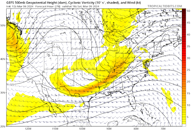
12z GEFS Mean 500mb Heights and Absolute Vorticity for Saturday at 18z courtesy of Tropical Tidbits.



Comments
Post a Comment